Showing posts with label Pacific Coast Highway. Show all posts

A Twilight Walk Along Moonstone Beach


After leaving Paso Robles (to read that post click here) and driving west back to the Pacific Coast Highway, we drove north towards the quaint little community of Cambria, California.  We decided to stop and stay for the night in a motel that was located right across the road from a section of Moonstone Beach. After checking into the motel my husband and I decided to take a sunset stroll along the beach, even though the sky was partially overcast like a woolly blanket stretched along the shoreline.


As the sun dipped below the horizon it struggled to send it's last glowing rays through the cloud bank and the unusual lighting made the ocean and beach appear like a shimmering mirror! It was truly a spectacular sight, and I could see that this area could be a photographer's paradise.

The beach held giant boulders and many smooth black stones that I collected as we walked along the shore.  We stopped in our tracks when we came across large mounds of kelp that had washed ashore in a prior storm.  When we first approached the long tangles of the brown cords (above photo lower right corner) I was reminded of legends of Medusa and other serpent haired monsters. The kelp looked like a living and breathing reptile ready to slither away, but in fact it was specimens of a beneficial brown algae plant called Macrocystis pyrifera that grows along the Pacific coast in large underwater forests. To learn some fascinating facts about the giant kelp forests along the Pacific Coast go to this page: Natural Marine Sanctuaries.


We saw a surfer leaving the beach as the light was slowly disappearing. Moonstone is a world class surfing destination as waves can be as high as 7.5 to 8 feet, and higher, at times.


Our twilight walk along Moonstone Beach left us with many very magical memories.


Back on the road the next morning we headed north along the Pacific Coast Highway to our next planned stop of San Simeon, where we wanted to visit the world famous Hearst Castle.


Can you see the castle high upon the mountain?  On my next post about our California trip along the coast from San Diego to San Francisco I'll take you there!  Meanwhile, come back to my blog on Wednesday for some more "Christmas in New York" city scenes!

I'm linking this post to "Mosaic Monday,"  "Blue Monday" and "Our World Tuesday" blog events.  Many thanks to all the blog hosts!


Bookmark and Share

Mission San Luis Obispo de Tolosa, California


When my husband and I drove into the town of San Luis Obispo, California, on our trip north along the Pacific Coast Highway from San Diego to San Francisco, we immediately headed over to the Mission San Luis Obsipo de TolosaWe had enjoyed seeing other historical Missions along the coast, and we wanted to also visit this Mission which is often called the "Prince of Missions."  The Mission is located in the middle of downtown San Luis Obispo, at the corner of Monterey and Chorro Streets.


As the fifth California Mission founded by Father Junipero Serra, on Sept. 1, 1772, it was named after Saint Louis, Bishop of Toulouse, France; a 14th century Franciscan. The Mission is located in a spacious valley along the central coast which the Spanish named "La CaƱada de los Osos" (Valley of the Bears) when they discovered many grizzly bears living there. 


The Mission church is unusual in its design. it has a combination of belfry and vestibule and a long secondary nave to the right of the altar which forms an L-shaped church plan. It is a design not found in any of the other California Missions.


The interior of the Mission was restored back to it's original state in 1934, and it is still used as an active parish church.


The San Luis Obispo de Tolosa Mission has a museum that features a rare collection of early California photographs, authentic Serra relics and specimens of Chumash Indian craftsmanship.


I found this collage of early 1900's photographs of all the 21 California Missions very interesting. Notice how many were in rural locations and now those same Missions have had cities grow up around them. 


The San Luis Obispo de Tolosa Mission grounds were beautiful.  Notice the red tile roofs and the long grape arbor. Under the three bells that were on display (upper left corner of the collage) was a commemorative plaque explaining that the Mission's original bells were lost to time, but these bells were two second and one third generation of bells, called "Joy," "Gloria" and "Sorrow." All of the Mission's bronze bells were usually made in Lima, Peru. Being a bell ringer at the Mission was an honor and it took up to two years to learn the bell ringing craft, as there were complicated bell patterns used to wake the mission inhabitants in the morning, call them to mass and announce the beginning of the siesta. The last two bell ringers at San Luis Obispo did this job for over 60 years each!


The photo on the left of Ah Louis (Wong On), 1840 -1936 - a prominent historical figure who helped to build the town of San Luis Obispo, was in the Mission's museum.  His store is now a historical landmark. The bell located next to the store was donated by Howard Wong Louis, his son, in memory of his father.  Ah Louis was a Chinese American pioneer who founded his store in 1874 to serve as a grocery and merchandise store, employment office, bank post office and pharmacy.  The store was used by the Chinese laborers that were living in the area and working to dig the eight tunnels through the mountains of Cuesta for the Southern Pacific Railroad, from 1884 to 1894.


Our next stop was the third largest wine growing region of California, beautiful Paso Robles, where I was surprised again to be greeted by a statue that I have been fortunate enough to see in Florence, Italy, in Sonoma, California and in Sydney, Australia. Can you guess what it is? If not, I'll be showing it in an upcoming post. It definitely seems to be an unusual "good luck" charm for me!


I'm linking this post to the "Outdoor Wednesday" event on Susan's blog A Southern Daydreamer. Thank you, Susan!


Bookmark and Share

The Madonna Inn--It's All About PINK!


When I am on the road on a vacation I bring my laptop along to stay in touch as much as possible with my favorite blogs and to answer comments. Sometimes my computer time is limited, or Internet connections are slow, so I fall a little behind.  Luckily, I decided to catch up with Susan's Branch's wonderful blog the evening before my husband and I were going to drive up to the San Luis Obsipo. While browsing a few back posts on her blog, I came upon her description of the Madonna Inn on her "We Love Pink" blog post.  What a exceptionally fun place this is for anyone that loves the color pink!


The Madonna Inn, located at 100 Madonna Road, San Luis Obispo, opened for business in 1958. It quickly became a landmark on US Highway 101 in the Central Coast of California.  The Inn was created by Alex Madonna, a successful construction magnate and entrepreneur, with and his wife Phyllis.

The pink begins outside the inn, but it can hardly prepare you....


 ...for all the pink inside!


According to Susan Branch, "Mr. Madonna made the whole thing pink because he thought Mrs. Madonna 'looked good in pink.' "


The banquets are pink....


...the tables and chairs are pink...


 ...parts of the bar are pink


...the carpet and decorations are pink!


Almost everything is pink!


As Susan said in her blog post: "the men’s room downstairs is so interesting, there’s always a line of women waiting to get in to see it!"  No photo here, as I wouldn't want to ruin the surprise, but it is one of the fun, quirky features of the inn you would want to see!


The fun does not end in the inn's lobby, men's room, Copper Cafe, Silver Bar, The Gold Rush Steak House Restaurant, or the attached bakery and pastry shop.  There are also 110 rooms, each decorated with a special theme.  If you go to this link you can see the whimsical names of the suites and a photo of how they are decorated. To continue the all pink theme, the room "Carin" was the one to choose, but there are many rooms in other colors available. One room, called "What's Left," is a patchwork of fabrics, carpet and wallpaper collected from other rooms.  If I had to chose, I thought Yosemite Rock was one of the nicest of the unusual rooms.  Which one would you chose?

Thanks, Susan, for letting us all know about the wonderful Madonna Inn!  I really enjoyed my visit!

I'm linking this post to:

Many thanks to all the blog hosts!

Bookmark and Share

Old Mission Santa Barbara, California


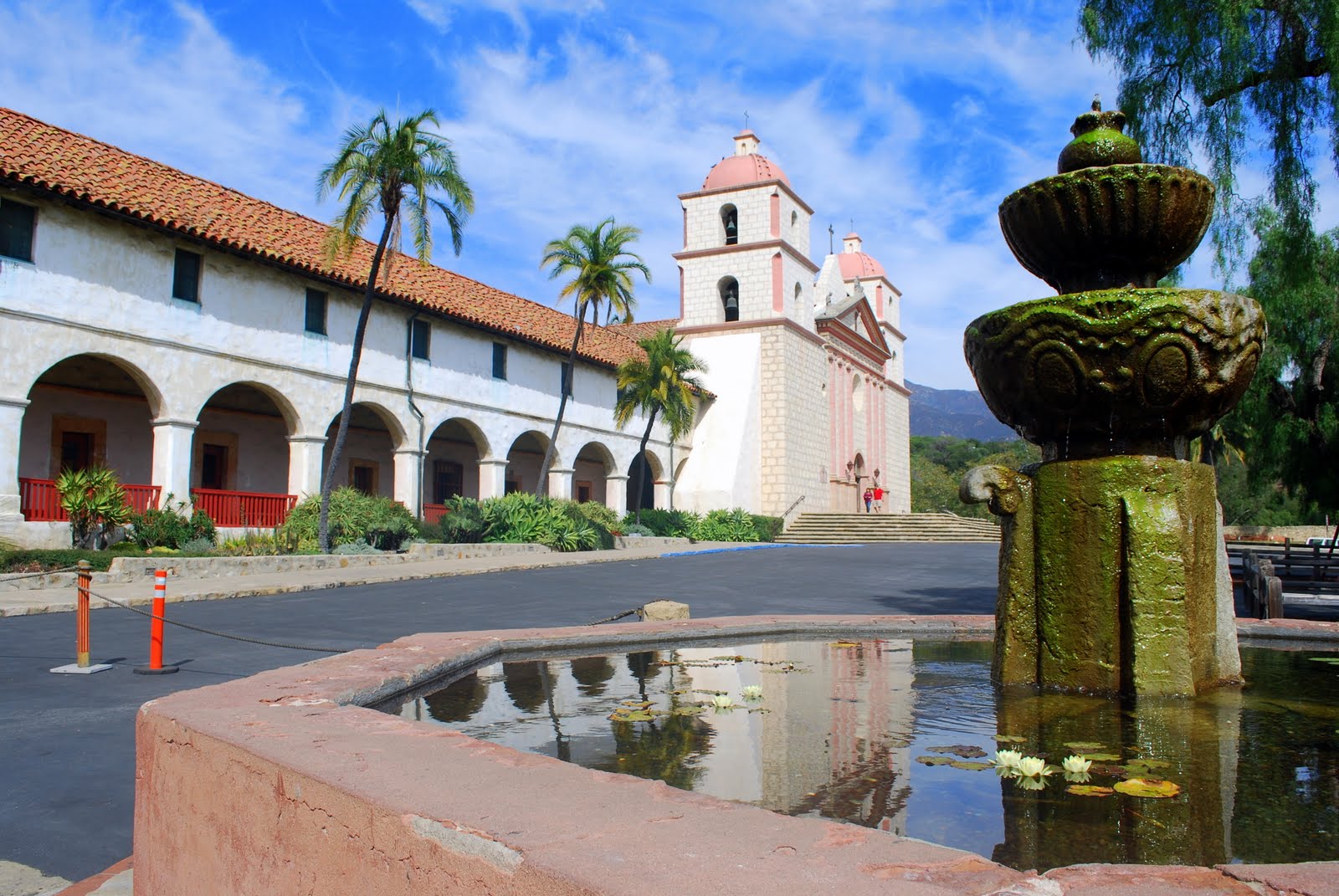
During our recent visit to California, my husband and I were so captivated by the beauty of the Mission of San Juan Capistrano, which you can read about on this link, that we decided to visit  a few more missions along the path of our Pacific Highway coastal trip to San Francisco. The Mission of Santa Barbara is located at 2201 Laguna Street, was founded in Founded  on the Feast of St. Barbara, December 4, 1786, and is known as the "Queen of the Missions."   It was the first to be christened by Father Fermin Lasuen, and has continuously served as a parish church for the local population since its founding.


Santa Barbara was the tenth of twenty-one California Missions to be founded by the Spanish Franciscans. The original church was destroyed in 1925 by earthquake, but restorations have returned it to its original grandeur, and its twin bell towers and Doric facade present an imposing impression of strength.


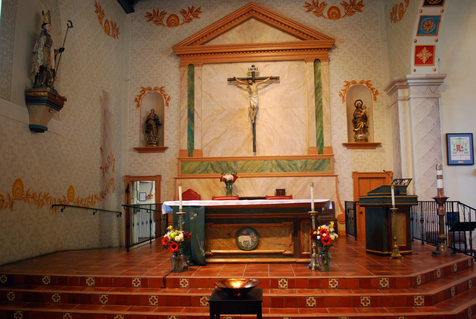
The interior of the church is impressive.  Its walls are full of beautiful religious themed paintings.


Some of the artwork and statues inside the Mission Santa Barbara Church.


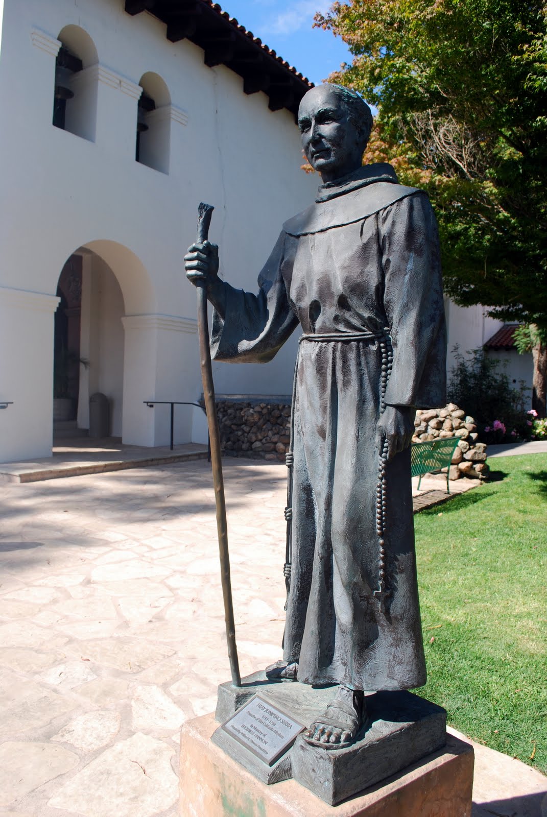
A tribute statue to Father Junipero Serra, who had founded the first nine Missions, and had died 2 years before Mission Santa Barbara was founded. Notice the "El Camino Real, " or The Royal Highway, bell marker behind the statue.  The missions were placed a day's walk from each other, about thirty miles apart. The entire span of missions along the El Camino Real is 650 miles, mainly along the present Highway 101.  In the1920s bronze mission bells were placed along the highway to let motorists know they were traveling the historic El Camino Real, although almost all of them no longer contain signs that indicate the distance to the next Mission, as this one does.


The beautiful fountain in front of the Mission was built in 1808.


When the Mission period was over, the buildings were used for a number of purposes, such as a high school, a junior college, a seminary, and the Mission church today is used by the Roman Catholic Parish of St. Barbara.


The Mission occupies over 10 acres of beautifully manicured gardens, and also houses a museum.


Some of the beautiful pink roses in bloom in the Mission garden.


Just look at the size of this grape vine remnant from the year 1800!


Some of the interesting artifacts inside the Mission's museum.


The small carving above this door tell you that you are now entering the Mission cemetery.


Santa Barbara's culturally diverse early settlers are buried here as well as approximately 4,000 Indians, including Joana Maria, the abandoned woman of San Nicolas island. Her life is portrayed in the book "Island of the Blue Dolphins." She was buried here in 1853 but the exact location of her grave is not known.


Another interesting sight in the cemetery was a large  Moreton Bay Fig Tree that was planted around 1890.


After our visit to the Mission of Santa Barbara we headed back onto the road, but this time we were taking a slight detour inland off the Pacific Coast Highway towards the Saint Inez Mountains to stay in a town that recommended by one of my husband's co-workers. I'm sure you will want to return to my blog to see it in my next post,  as you will find it absolutely delightful!

I am linking this post to:

"Pink Saturday" on Beverly's blog How Sweet The Sound
"Spiritual Sunday" on the Spiritual Sunday blog
"Seasonal Sundays" on The Tablescaper blog

Many thanks to all the blog hosts!
Pam of the blog "Abiding in Love" is doing a My Memories Digital Scrapbook give away and asked me to spread the news! If you remember, I did a give away of this wonderful software a short time ago and I have been enjoying using it to make pages of my grandson's photos. Please visit Pam's blog and leave a comment to have another chance to win this wonderful software.


If you can't wait to win,  you can go to the My Memories web site and order this voted  #1 digital scrapbook software no.  If you enter this code STMMMS34516 at check out, you will receive $10 off the price! It's a wonderful opportunity to finally scrap all those wonderful photos you have in your computer files.


Bookmark and Share

Stearns Wharf, Santa Barbara


On the second day of the drive that my husband and I made along the California Pacific Coast road from San Diego to San Francisco, we left Santa Monica, where we stayed for the night, and began the day bright and early as we knew we'd have many miles to cover.  At this point we are approaching Point Mugu in Ventura County.


Here we are about to pass by Mugu Rock, a distinctive feature of the coastal headway promontory that has been featured in hundreds of film shoots and television commercials. The Rock was formed when a path for the highway was cut through the mountain. It marks a western end of the Santa Monica Mountains.  The Pacific Coast Highway leaves the coastline at this point and travels inland for a portion towards the city of Oxnard.


Oxnard, also known as the "Gateway to the Central Coast," is the lima bean and strawberry capital of California.   We drove by many such farms before the highway returned to the coast.

.

As we approached Santa Barbara, beautiful beaches were on one side of the Pacific Coast Highway and....


...the beautiful Santa Ynez Mountains on the other side.


We knew we would only have time for a brief stop in Santa Barbara, so we had to chose a few sights to see.  We decided to drive onto Stearns Wharf.  Stearns Wharf was completed in 1872 and became the longest deep-water pier between Los Angeles and San Francisco.  Named for its builder, local lumberman John P. Stearns, the wharf served the passenger and freight shipping needs of California's South Coast for over a quarter century.


Over the years Stearns Wharf served many other purposes and survived earthquakes and multiple fires. It now contains shops and restaurants and is visited by 5 million people a year, making it one of Santa Barbara's largest tourist attractions.


A look back from the end of the 1,950 long wharf to the coastline.


Although we couldn't see them, we could hear seals barking off shore at the end of the pier.


A view of the city of Santa Barbara and the Santa Ynez Mountains from Stearns Wharf.


The Channel Islands of Anacapa, Santa Cruz, Santa Rosa, San Miguel, and Santa Barbara lie in the Pacific Ocean off the coast of Southern California, as you can see by the map above, and are part of the Channel Islands National Park.


The Ty Warner Sea Center (owned and operated by the Santa Barbara Museum of Natural History) is located on Stearns Wharf and fulfills the mission of the Museum to inspire a passion for the natural and marine world to its visitors.


There were quite a few pelicans resting on the wharf.


Another view of the wharf taken from the front of the Ty Warner Sea Center.


We had a shrimp tacos for lunch and enjoyed the view.


This fellow hoped I'd share my lunch with him...he was left very disappointed!


After we left Stearns Wharf we continued to our next stop: Old Mission Santa Barbara. More about this historical mission on my next blog post!


I'm adding this post to Jenny Matlock's Alphabe Thursday for the letter "C" -- California!


Bookmark and Share