Showing posts with label Friday Finding Beauty. Show all posts

Yosemite Falls, Olmsted Point, Tuolumne Meadows and the Tioga Road


This is my fourth and final post for now about our trip to Yosemite National Park in California. This is what we saw of Yosemite Falls when we visited at the end of the month of August, 2010. It was just a trickle of water and not the thunderous waterfall it is in the spring, when all the heavy snow melt occurs. Yosemite Falls is one of the tallest in North America and fifth highest in the world with a total drop of 2,425 feet.


You can watch this short video to see what the famous Yosemite Falls looks like in Spring and also to see some of the other natural attractions in the park.


A close up of the late summer falls from the park's new viewing point.


A closer zoom in of the late summer conditions of Yosemite Falls  Considering the temperature in the Yosemite Valley was in the 90's that day I was surprised to see any water flowing at all! 
One advantage to visiting the park in late summer, however, was that there were less visitors and it was very easy for us to drive throughout the park without traffic delays. About 4 million people visit Yosemite National Park in a year as it is one of the most popular parks.

Our son had visited Yosemite National Park a few years ago and told us that the views approaching the eastern entrance to the park were spectacular and not to be missed, so we decided to leave the valley and drive to higher elevations towards the east.


We passed this gnarled old wind swept sequoia tree along the way and had to stop to take it's photo. Just imagine all the severe weather conditions it has survived!


 We stopped at the beautiful Olmsted Point overlook.


Informational placard about Olmsted Point. Please click on once to enlarge, and then again when it opens on a new page for easier viewing. All photos will enlarge this way.


Olmsted Point, along the Tioga Road, looks down on Yosemite Valley from the east--and from a very different angle. You can see Clouds Rest and Half Dome in the distance.


Half Dome is one of the most prominent peaks seen from Olmsted Point when looking west.


Tenaya Lake as seen from Olmsted Point looking towards the east.


Notice Fairview Dome at the bottom right, which we will see again in an upcoming photo.


Tenaya Lake is a magnificent High Sierra lake surrounded by granite domes, lodgepole forests, and Yosemite's vast wilderness. It is the largest lake in Yosemite's front country.


Tuolumne Meadows and Yosemite's high country, traversed by the Tioga Road, offer some of the Sierra Nevada's most rugged, sublime views.  At an elevation of 8,600 feet above sea level it is the largest sub-alpine meadow in the Sierra Nevada.


It is 55 miles, approximately 90 minutes by car, from Yosemite Valley via the Tioga Road. Many miles of trails radiate from this area and it is a primary wilderness threshold for hikers.


The Tuolumne Meadows area is graced by the winding Tuolumne River and surrounded by majestic peaks and domes.


Pothole Dome is a granite dome on the West side of Toulumne Meadows that shows interaction of the last ice age. In particular, the stranded, rounded boulders from a glacier that has long since retreated, and the water-eroded "potholes" provide evidence of two ways that water can interact with granite
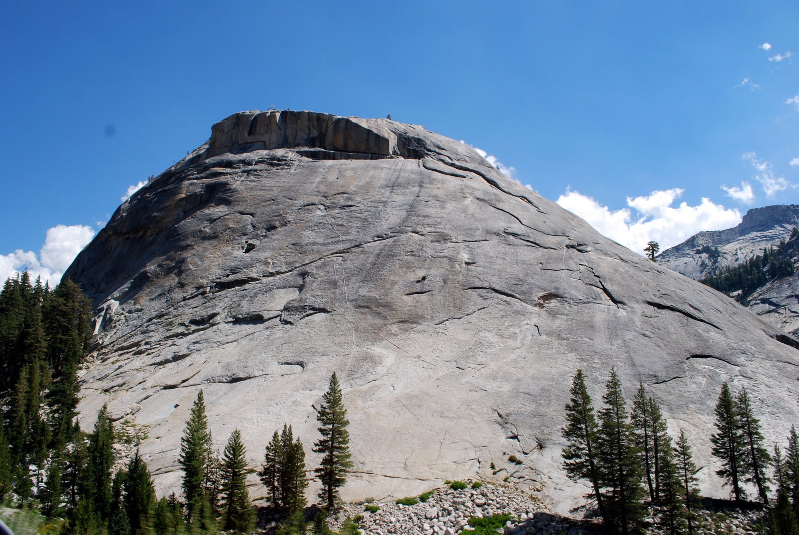

Here is Fairview Dome again, which is by far the largest of the many outstanding domes in the Tuolumne region.


Lembert Dome is another granite dome rock formation that soars 800 feet above Tuolumne Meadows.

Due to the high elevation and snow accumulation the Tioga Road is closed to vehicle traffic during the winter and spring, but a visitor center, lodging, camping, food service, and gasoline are available in Toulumne Meadows in summer.


We drove out the East Entrance of Yosemite National Park on Tioga Pass. The elevation at this point is 9,945 feet altitude.


We continued driving east outside the park.


We passed Ellery Lake, with an elevation of 9,538 feet.


An interesting informational placard along a turn out on the road about the building of Tioga Road. Please click to enlarge.


The views along the road of the rugged terrain are spectacular!


Another turn out overlook on the Tioga Road.


A close up of the interesting informational placard showing the length of Tioga Pass and Road as it travels into Yosemite National Park.  At 9,945 feet it is the highest automobile pass in California. Constructed in 1883, and 1910, it is a civil engineering marvel and called one of the most scenic mountain roads in all of California!


If you look closely you can see the Tioga Road continuing along the base of the mountain to the left.


We drove along Tioga road to Mono Lake. Mono Lake is the largest natural lake completely within the state of California. Once endangered when water feeding it was diverted toward the Los Angeles basin, it lost half its volume in the 40 years before an agreement was reached to save it.

At this point we turned around and returned to Yosemite National park and actually drove to see the Hetch Hetchy Reservoir and the O'Shaughnessy Dam, but that will be a blog post for another time in the future.

I hope you enjoyed seeing this portion of Yosemite and the Tioga Road, a view that is not as often traveled as much as the western portion of Yosemite National Park is. Yosemite is truly one of the most beautiful parks in the American national park system, and one of most preserved untouched wilderness in our country.

I'm linking to Susan's "Outdoor Wednesday" on her blog A Southern Daydreamer, and Cathy's Adventure Express on her blog A Bit of the Blarney. Please visit Susan and  Cathy today to see their posts and the links to all the blogs participating today.

I'm linking this post to Jenny Matlock's "Alphabe Thursday." The letter this week is "C" and I can't think of anything better than the state of California and it's gem, Yosemite National Park!


I'm also linking it to Claudia's "Friday Finding Beauty" on her blog Dippity Road, and Sandi's "Friday Favorite Linky Party" on her blog The Whistlestop Cafe.

Please visit all these wonderful blogs and join in all the fun!


Bookmark and Share

Yosemite National Park Valley - Part One


In my last post we left the awe inspiring Glacier Point in Yosemite National Park and drove into the Wawona Tunnel. Just after exiting Wawona Tunnel and entering the valley from the south you will see one of the most famous views of Yosemite Valley called the Tunnel View.


You will see El Capitan and the Bridalveil Falls on opposite sides of the valley, and Half Dome in the distance.


Enlarge to read this historical look back in time.  As always, all photos can be enlarged by clicking on them once and then again when they open on a new page.


The Bridalveil Falls is often the first waterfall visitors see when entering Yosemite Valley. In spring, it is thunderous; during the rest of the year it has a light, swaying flow.  * Please note: the spelling of "Bridalveil" as one word is not a misspelling -- it is spelled this way on the National Park Service Yosemite web site.


We hiked to the base of the falls and watched the pretty formations of water which did at time resemble a gauzy veil, as you can see in the photo collage above.


The first sight of El Capitan from the valley floor is impressive! It is a 3,000 foot high block of granite on the Northern side of Yosemite Valley, and it is the largest monolith of granite in the world.


The size of all the walls of granite peaks surrounding the valley are tremendous.


"In God's wildness lies the hope of the world." ~ John Muir


Some views of the beautiful Ahwahnee Hotel located in the Yosemite Valley.

The hotel web site states: "The Ahwahnee shines as Yosemite National Park’s distinctive AAA® Four-Diamond hotel.  Known for its magnificent façade, and architecture, The Ahwahnee was specifically designed to highlight its natural surroundings, featuring Yosemite Falls, Half Dome and Glacier Point.  The destination of queens and presidents alike, The Ahwahnee offers a perfect balance of history, hospitality and elegance."


Cathedral Rocks and Spires, opposite El Capitan, form the Eastern side of the canyon through which Bridalveil Creek flows.


The Merced River is approximately 112 miles long, flowing from the Sierra Nevada into the Central Valley and San Joaquin River, which ultimately flows into the Pacific Ocean.  According to the Yosemite National Park web site: "In 1987 the U.S. Congress designated the Merced a Wild and Scenic River to preserve its free-flowing condition and to protect and enhance the unique values that made it worthy of special protection under the Wild and Scenic Rivers Act. Both the Merced River above, through, and below Yosemite Valley, and the South Fork of the Merced above, through, and below Wawona have this special status."


A more distant view of the Bridalveil Falls.


El Capitan glowing as the late afternoon sun shines on it.


In the late afternoon the deer come down into the valley to look for fresh greenery to eat. We spotted this young doe near a trail we were walking on.


This little fellow came right up to me begging for food. Unfortunately, visitors throw snacks to some of the animals which is frowned upon. There are many signs throughout the park asking not to feed the animals as they then do not learn to scavenge their own food and suffer when winter comes and the amount of visitors decline.  Also, many precautions are made to secure disposed of food in bear proof containers to prevent the bears from looking for human garbage to eat.  This protects both the visitors and the bears.


A view taken from the Swinging Bridge. The famous Yosemite Falls would be visible from this point, flowing down the peaks in the distance, but as we visited in late August the waterfall was only a trickle in size as it is fed mostly by snow melt.

In my next blog post I'll show what we did see of Yosemite Falls, also Tuolumne Meadows and some magnificent views from Olmsted Point and Tioga Pass.


I'm linking this post to Jenny Matlock's "Alphabe Thursday." The letter this week is "B" for Bridalveil Falls.
I'm also linking it to Claudia's "Friday Finding Beauty" on her blog Dippity Road, and Sandi's "Friday Favorite Linky Party" on her blog The Whistlestop Cafe.

Please visit all three blogs over the next two days and join in all the fun!


Bookmark and Share

A Lazy, Hazy, Day of Summer


After our visit to Gateway National Recreation Area (my last blog post), my husband and I drove across The Marine - Gil Hodges Bridge which connects the south east section of Brooklyn, New York to the Rockaway peninsula in Queens. On the other side of the peninsula are the beaches and the Atlantic Ocean, and if you look to the left under the bridge you can see the historic bathhouse towers of Jacob Riis Park.


We drove to Rockaway to visit a cozy little bar/restuarnat called "The Wharf," as it has a nice view of Jamaica Bay.

The Wharf deck is connected to a gang plank and most of the customers arrive by boat.....

....and yachts..

...and even kayaks!

On a weekend, or a hot day, it is a busy place.

We stopped by for some clams on the half shell...


...and fish tacos that had a tasty creamy cilantro lime dressing.


It was a cool and relaxing way to spend an afternoon during the July 4th weekend.


If you look closely in this photo, through the summer haze, on the left you can see the skyscrapers of Manhattan in the distance, and the island in the center is one of the Jamaica Bay's Wildlife Refuge areas.  A birder's paradise, there are more than 330 bird species that have been sighted at the refuge over the last 25 years; that is nearly half the species in the Northeast. It is one of the most significant bird sanctuaries in the Northeastern United States and one of the best places in New York City to observe migrating species.

Watching the sailboat made me wish I was sailing on the bright blue water of the bay... and hopefully I may get my wish tomorrow, if weather permits. 


I'm adding this post to Jenny Matlock's "Alphabe Thursday."  The letter this week is "Y" and I hope the yacht in this post qualifies. I'm also adding it to Claudia's "Friday Finding Beauty" on her blog Dippity Road.  Please visit both blogs and join in all the fun!


Bookmark and Share